Collection: Smith Collection
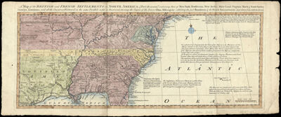
Name: A Map of the British and French Settlements in North America : [Part the second] containing Part of New York, Pensilvania, New Jersey, Mary Land, Virginia, North & South Carolina, Georgia, Louisiana, and all the Countries Westward in the same Parallels so far as Discovered, shewing the Course of the Rivers Ohio, Missisipi &c., exhibiting the just Boundaries & the French Encroachments Laid down from Authentic Surveys.
Barcode:
Date/Date Range Produced:
Date/Date Range Published:
Language:
Dimensions: 19 x 49
Printing Process:
Printing Technique:
Material Type:
Notes:
LC Call Number: G3230 .B6 1759
OCLC: 138099215
Accession Number: SM-1759-5
Donor:
Permenant URL: