A Map of the Coast of New England, from Staten Island to the Island of Breton, as it was actualy Survey'd by Capt. Cyprian Southack. Sold by Iohn Senex at the Globe overagainst St. Dunstan's Church in Fleetstreet: who also makes & sells Globes & Maps with new improvements

Collection: Osher Collection

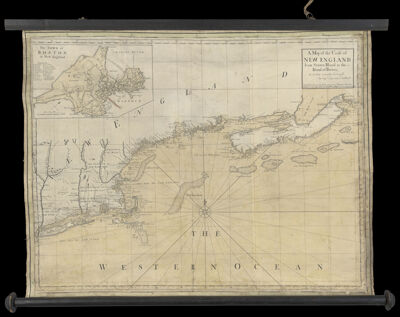
Name: A Map of the Coast of New England, from Staten Island to the Island of Breton, as it was actualy Survey'd by Capt. Cyprian Southack. Sold by Iohn Senex at the Globe overagainst St. Dunstan's Church in Fleetstreet: who also makes & sells Globes & Maps with new improvements

Barcode: 635

Creator: Senex, John, -1740Southack, Cyprian, 1662-1745

From Atlas: No

Notes: Map is attached to two wooden dowels

Publisher: Mount, William, -1769

Purveyor: Senex, John, -1740

Date/Date Range Produced: 1735

Date/Date Range Published: 1735

Language: English

Region Depicted: ConnecticutLong Island, New YorkMaineMassachusettsNew EnglandNew HampshireNova ScotiaRhode Island

Map Type: Nautical charts

Dimensions: H 67.5 x W 92 cm

Printing Process: Engraving

Printing Technique: Copper

Material Type: Paper

LC Call Number:

OCLC: 86085001

Donor: Osher

Permenant URL: https://oshermaps.org/map/635.0001