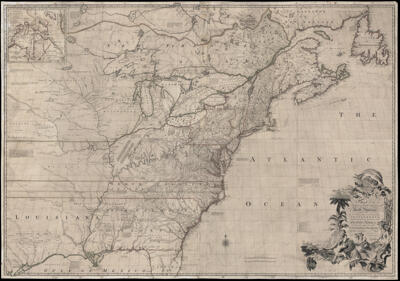
A Map of the British and French Dominions in North America. WITH THE Roads, Distances, Limits, and Extent of the SETTLEMENTS, Humbly Inscribed to the Right Honourable The Earl of Halifax, And the...
Collection: Osher Collection
Name: A Map of the British and French Dominions in North America. WITH THE Roads, Distances, Limits, and Extent of the SETTLEMENTS, Humbly Inscribed to the Right Honourable The Earl of Halifax, And the...
Barcode: 682
Creator: Mitchell, John, 1711-1768
Date/Date Range Produced: 1755
Date/Date Range Published: 1755
Language: English
Region Depicted: Eastern CanadaEastern United StatesGreat Lakes Region (North America)Halifax, Nova ScotiaMiddle Atlantic StatesMississippi RiverNew EnglandNortheastern StatesQuébec City, CanadaQuébec, CanadaSoutheastern states
Map Type: GeographicalHistorical mapsWall maps
Dimensions: W 196 x H 138 cm
Material Type: Linen
LC Call Number:
OCLC:
Donor: Osher
Subjects: Colonial AmericaColonial settlements in America
Permenant URL: https://oshermaps.org/map/682.0001