Collection: Osher Collection
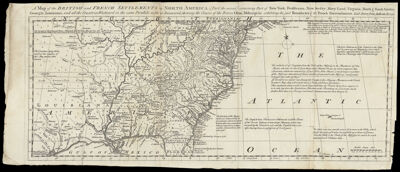
Name: A map of the British and French settlements in North America : [part second] containing part of New York, Pensilvania, New Jersey, Mary Land, Virginia, North & South Carolina, Georgia, Louisiana, and all countries westward in the same parallels so far as discovered shewing the course of the rivers Ohio, Missisipi & c., exhibiting the just boundaries & the French encroachments laid down from authentic surveys
Barcode:
Notes:
Date/Date Range Produced:
Date/Date Range Published:
Language:
Dimensions: H 21.7 x W 51.6 cm
Printing Process:
Printing Technique:
Material Type:
LC Call Number:
OCLC: 138099215
Donor:
Permenant URL: