[Ritter's sundial map]

Collection: Osher Collection

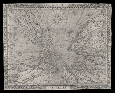
Name: [Ritter's sundial map]

Barcode: 419

Creator: Ritter, Franz, -1641

Publishing Location: Nuremburg

Notes: Map is projected from the North Pole as if it were a sundial. Includes bizarre illustrations of native peoples, animals, ships, sea monsters and a mermaid.Title supplied by cataloger.

Date/Date Range Produced: 1640

Date/Date Range Published: 1640

Language: Latin

Dimensions: 25 x 32 cm.

Printing Process: Engraving

Printing Technique: Copper

Material Type: Paper

LC Call Number: G3200 .R5 1640

OCLC: 76951283

Donor: Osher

Permenant URL: https://oshermaps.org/map/419.0001