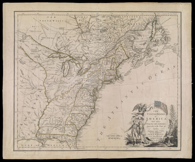
The United States of America laid down from the best Authorities, agreeable to the Peace of 1783. Published, April 3rd, 1783 by the Proprietor John Wallis, at his Map-Warehouse , Ludgate Street London.
Collection: Osher Collection
Name: The United States of America laid down from the best Authorities, agreeable to the Peace of 1783. Published, April 3rd, 1783 by the Proprietor John Wallis, at his Map-Warehouse , Ludgate Street London.
Barcode: 853
Creator: Wallis, J. (John), -1818
From Atlas: No
Publisher: Wallis, J. (John), -1818
Date/Date Range Produced: 1783
Date/Date Range Published: 1783
Language: English
Region Depicted: AlabamaArkansasConnecticutDelawareEastern CanadaFloridaGeorgiaIllinoisIndianaKentuckyLouisianaMaineMaritime ProvincesMarylandMassachusettsMichiganMinnesotaMississippiMissouriNew HampshireNew JerseyNew York (State)Newfoundland and LabradorNorth CarolinaNova ScotiaOhioOntarioPennsylvaniaRhode IslandSouth CarolinaTennesseeVermontVirginiaWest VirginiaWisconsin
Map Type: GeographicalPolitical maps
Dimensions: 46 x 58 cm. on sheet 52 x 63 cm.
Printing Process: Engraving
Printing Technique: Copper
Material Type: Paper
LC Call Number:
OCLC: 841170900
See Also: A New Map of the United States of America, from the best authorities.
Donor: Osher
Permenant URL: https://oshermaps.org/map/853.0001