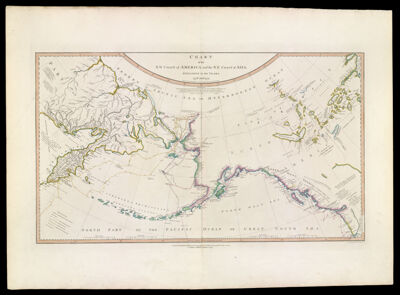
Chart of the N.W. Coast of America and the N.E. Coast of Asia, explored in the years 1778 and 1779.
Collection: Osher Collection
Name: Chart of the N.W. Coast of America and the N.E. Coast of Asia, explored in the years 1778 and 1779.
Barcode: 883
Creator: Delarochette, L. (Louis), 1731-1802Roberts, Henry, 1757-1796
From Atlas: No
Notes: Note below title: "Prepared by Lieut. Heny. Roberts, under the immediate inspection of Capt. Cook." Note at bottom right: "Engraved by W. Palmer, No. 128 Chancery Lane" Note below map: "London. Published by WM. Faden, Geographer to the King, Charing Cross, July 24, 1784. 2nd edition published January 1st, 1794."
Publisher: Faden, William, 1749-1836
Date/Date Range Produced: 1794
Date/Date Range Published: 1794
Language: English
Region Depicted: AlaskaAleutian Islands (Alaska)AsiaBering SeaCanadaNorth AmericaPacific OceanRussia
Map Type: GeographicalNautical charts
Dimensions: 39 x 67 cm. on sheet 58 x 80 cm.
Printing Process: Engraving
Printing Technique: Copper
Material Type: Paper
LC Call Number:
OCLC: 73435012
Donor: Osher
Subjects: AlaskaAleutian Islands (Alaska)AsiaBering SeaCanadaCoastsExploration and discoveryExplorersMaps--Early works to 1800Nautical chartsNorth AmericaPacific OceanRussia
Permenant URL: https://oshermaps.org/map/883.0001