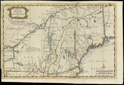
A Map of that part of America which was the Principal Seat of War, in 1756.
Collection: Osher Collection
Name: A Map of that part of America which was the Principal Seat of War, in 1756.
Barcode: 714
Creator: Gentleman's magazine (London, England)
From Atlas: No
Notes: Appears to be copy 3 of OS-1757-3, but colored
Date/Date Range Produced: 1757
Date/Date Range Published: 1757
Language: English
Region Depicted: CanadaMaineMassachusettsNew EnglandNew HampshireNew York (State)OntarioPennsylvaniaSaint Lawrence River ValleyVermont
Map Type: GeographicalPolitical maps
Dimensions: H 23.6 x W 35.2 cm
Printing Process: Engraving
Printing Technique: Copper
Material Type: Paper
LC Call Number:
OCLC: 8647193
Donor: Osher
Permenant URL: https://oshermaps.org/map/714.0001