A New Map of Nova Scotia, and Cape Breton Island with the adjacent parts of New England and Canada, Composed from a great number of actual Surveys, and other materials Regulated by many new Astronomical Observations of the Longitude as well as Latitude: by Thomas Jefferys, Geographer to the King., copy 3

Collection: Osher Collection

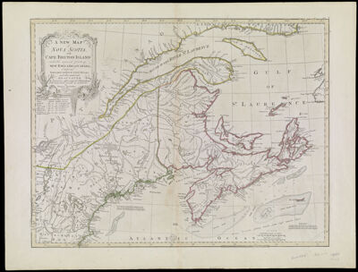
Name: A New Map of Nova Scotia, and Cape Breton Island with the adjacent parts of New England and Canada, Composed from a great number of actual Surveys, and other materials Regulated by many new Astronomical Observations of the Longitude as well as Latitude: by Thomas Jefferys, Geographer to the King., copy 3

Barcode: 784

Creator: Jefferys, Thomas, 1710-1771

From Atlas: No

Notes: Copy 3 of OS-1775-15

Publisher: Robert Sayer and John Bennett (Firm)

Purveyor: Robert Sayer and John Bennett (Firm)

Date/Date Range Produced: 1775

Date/Date Range Published: Jun 15th, 1775

Language: English

Region Depicted: CanadaMaineMaritime ProvincesMassachusettsNew EnglandNew HampshireNova ScotiaVermont

Map Type: GeographicalPolitical maps

Dimensions: 48 x 62 cm. on sheet 55 x 73 cm.

Printing Process: Engraving

Printing Technique: Copper

Material Type: Paper

LC Call Number:

OCLC: 5409028

Donor: Osher

Permenant URL: https://oshermaps.org/map/784.0001