Collection: Story Collection
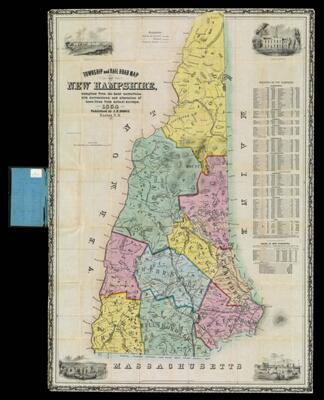
Name: Township and Railroad Map of New Hampshire : compiled from the best authorities with corrections and alteration of town lines from actual surveys
Barcode:
Creator:
Publishing Location:
Notes:
Date/Date Range Produced: 1854
Language:
Region Depicted:
Dimensions: 88 x 60 cm. folded to 14 x 8 cm
LC Call Number: G3731.A5 1854
OCLC: 414975979
Accession Number: ST-1854-29
Donor:
Permenant URL: