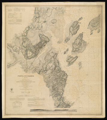
Portland Harbor Maine : From a Trigonometrical Survey under the direction of A.D. Bache Superintendent of the Survey of the Coast of the United States Triangulation by C.O. Boutelle Assistant U.S.C.S. Topography by A.W. Longfellow Assist. Hydrography by the Parties under the command of Lieuts. Comdg. M. Woodhull, T.A. Craven, F.A. Roe and J. Wilkinson U.S.N. Assts.
Collection: Osher Collection
Name: Portland Harbor Maine : From a Trigonometrical Survey under the direction of A.D. Bache Superintendent of the Survey of the Coast of the United States Triangulation by C.O. Boutelle Assistant U.S.C.S. Topography by A.W. Longfellow Assist. Hydrography by the Parties under the command of Lieuts. Comdg. M. Woodhull, T.A. Craven, F.A. Roe and J. Wilkinson U.S.N. Assts.
Barcode: 1122
Creator: Array
Printmaker: Array
From Atlas: No
Publishing Location: Washington D.C.
Notes: Chart No. 325. Notes: ""Red'd. Dr'ng. by P. Witzel & A. Balbach." "Electrotype copy no. 4 by G. Mathiot, U.S.C.S" "Additional Hydrography by C.A. Schott & E. Cordell Assts. in 1861 & '62"
Publisher: United States Coast Survey
Surveyor: Bache, A. D. (Alexander Dallas), 1806-1867
Date/Date Range Produced: 1866
Date/Date Range Published: 1866
Language: English
Region Depicted: Portland Harbor, Maine
Map Type: Nautical chartsTopographical maps
Dimensions: 72 x 64 cm.
Printing Process: Electrotype
Material Type: Paper
LC Call Number:
OCLC: 174970251
Accession Number: OS-1866-17
Donor: Osher
Subjects: Bache, A. D. (Alexander Dallas), 1806-1867CoastsHarborsIslandsMaine--MapsNautical chartsPortland (Me.)Portland Harbor, MaineUnited States Coast SurveyWitzel, P.
Permenant URL: https://oshermaps.org/map/1122.0001