Collection: Osher Collection
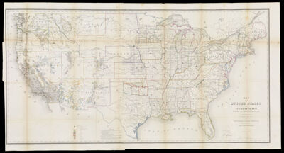
Name: Map of the United States and Territories. Shewing the extent of Public Surveys and other details constructed from the Plats and official sources of the General Land Office under the direction of the Hon. Jos. Wilson Commissioner. By Theodore Franks Draughtsman 1866.
Barcode:
Creator:
Publishing Location:
Notes:
Date/Date Range Produced:
Date/Date Range Published:
Language:
Region Depicted:
Dimensions: H 78 x W 146 cm
LC Call Number: G3701.B5 1866.F7
OCLC: 77787114
Donor:
Permenant URL: