Map of the state of Maine Drawn and Engraved especially for this Atlas.

Collection: Osher Collection

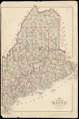
Name: Map of the state of Maine Drawn and Engraved especially for this Atlas.

Barcode: 1137

Creator: Anonymous / Unknown Author

Printmaker: Neumann, Louis E.

From Atlas: Yes

Publishing Location: New York

Notes: From: F.W. Beers & Co. Atlas of Cumberland County, Maine, 1871. Note "L. Neuman, Engraver, 95 Maiden Lane N.Y."

Atlas Reference: Atlas of Cumberland County, Maine, 1871

Subjects: Array

Publisher: F.W. Beers & Co.

Date/Date Range Produced: 1871

Date/Date Range Published: 1871

Language: English

Region Depicted: Maine

Map Type: GeographicalPolitical maps

Dimensions: H 59.8 x W 39 cm

Material Type: Paper

LC Call Number: G3734 .B4 1871

OCLC: 76881582

Donor: Osher

Permenant URL: https://oshermaps.org/map/1137.0001