A Map of the State of Maine from the Latest and Best Authorities. By Moses Greenleaf Esq. 1820.

Collection: Osher Collection

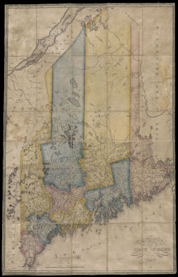
Name: A Map of the State of Maine from the Latest and Best Authorities. By Moses Greenleaf Esq. 1820.

Barcode: 931

Creator: Greenleaf, Moses, 1777-1834

Printmaker: Annin, William B., 1791?-1839

From Atlas: No

Publishing Location: Boston (Mass.)

Notes: Note under scale: "Engraved by W.B. Annin Boston." Map is segmented and mounted on linen.

Publisher: Greenleaf, Moses, 1777-1834

Date/Date Range Produced: 1820

Date/Date Range Published: 1820

Language: English

Region Depicted: Maine

Map Type: Boundary mapsGeographicalPolitical maps

Dimensions: 104 x 67 cm.

Printing Process: Engraving

Printing Technique: Copper

Material Type: Paper

LC Call Number:

OCLC: 878561899

Accession Number: OS-1820-9

Donor: Osher

Subjects: BoundariesCountiesMaineRivers and lakes

Permenant URL: https://oshermaps.org/map/931.0001