Collection: Osher Collection
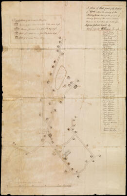
Name: A plan of that part of the District of Alfred within the vicinity of the Meetinghouse, taken for the purpose of shewing & proving the accommodations that can be had there for holding a Supreme Judicial Court, by copy, (signed) Wm. Parsons Survey
Barcode:
From Atlas:
Notes:
Surveyor:
Date/Date Range Produced:
Language:
Region Depicted:
Map Type:
Dimensions: H 77 x W 50 cm.
Printing Technique:
Material Type:
LC Call Number:
OCLC: 893908677
Donor:
Subjects:
Permenant URL: