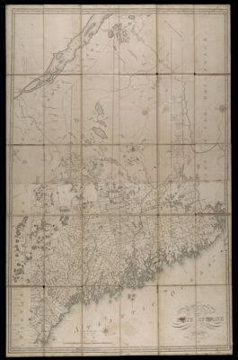
Map of the State of Maine from the Latest and Best Authorities. By Moses Greenleaf Esq. 1822.
Collection: Osher Collection
Name: Map of the State of Maine from the Latest and Best Authorities. By Moses Greenleaf Esq. 1822.
Barcode: 935
Creator: Greenleaf, Moses, 1777-1834
Printmaker: Annin, William B., 1791?-1839
From Atlas: No
Notes: Note below scale : "Engraved by W.B. Annin Boston". Note below neat line: "Published according to Act of Congress". Map is segmented and mounted on linen.
Date/Date Range Produced: 1822
Date/Date Range Published: 1822
Language: English
Region Depicted: Maine
Map Type: Boundary mapsGeographicalPolitical maps
Dimensions: H 104 x W 67 cm.
Printing Process: Engraving
Printing Technique: Copper
Material Type: Paper
LC Call Number:
OCLC: 878561702
Donor: Osher
Subjects: Annin, William B., 1791?-1839BoundariesCountiesMaineMaine--MapsRivers and lakes
Permenant URL: https://oshermaps.org/map/935.0001