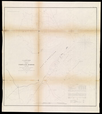
(A No.2) U.S. Coast Survey A.D. Bache Superintendent Chart of Portland Harbor Maine showing the Wharf Line recommended by Commissioners appointed by the City Authorities Hydrography by the parties under the command of Lieut. T.A. Craven & Lieut. M. Woodhull U.S.N. Assts.
Collection: Osher Collection
Name: (A No.2) U.S. Coast Survey A.D. Bache Superintendent Chart of Portland Harbor Maine showing the Wharf Line recommended by Commissioners appointed by the City Authorities Hydrography by the parties under the command of Lieut. T.A. Craven & Lieut. M. Woodhull U.S.N. Assts.
Barcode: 1061
Creator: Array
Printmaker: Array
From Atlas: No
Publishing Location: Washington D.C.
Notes: Note in upper right corner: Bowne & Hasbrouck Lith. N.Y." "No. 3" printed in upper left corner of sheet. Notes at bottom of the map: "Engd. by W. Ogilvie & app. F.W. Benner." and "Drg. by A. Balbach."
Publisher: Bowne & Hasbrouck Lith.United States Coast Survey
Date/Date Range Produced: 1855
Date/Date Range Published: 1855
Language: English
Region Depicted: Portland Harbor, Maine
Map Type: Nautical charts
Dimensions: H 62.4 x W 55.4 cm
Material Type: Paper
LC Call Number:
OCLC: 878561078
Donor: Osher
Subjects: Bache, A. D. (Alexander Dallas), 1806-1867Bowne & Hasbrouck Lith.HarborsMaine--MapsNautical chartsPortland (Me.)Portland Harbor, MaineUnited States Coast Survey
Permenant URL: https://oshermaps.org/map/1061.0001