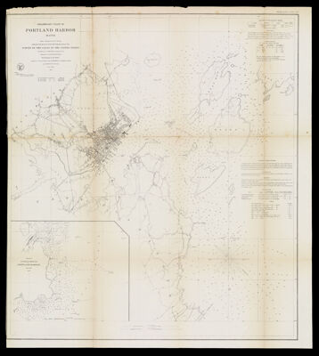
Preliminary Chart of Portland Harbor Maine From a Trigonometrical Survey under the direction of A.D. Bache Superintendent of the Survey of the Coast of the United States Triangulation by C.O. Boutelle Assistant U.S.C.S. Topography by A.W. Longfellow Assist. Hydrography by the Parties under the command of Lieuts. Comdg. M. Woodhull. T.A. Craven, F.A. Roe and J. Wilkinson U.S.N. Assts.
Collection: Osher Collection
Name: Preliminary Chart of Portland Harbor Maine From a Trigonometrical Survey under the direction of A.D. Bache Superintendent of the Survey of the Coast of the United States Triangulation by C.O. Boutelle Assistant U.S.C.S. Topography by A.W. Longfellow Assist. Hydrography by the Parties under the command of Lieuts. Comdg. M. Woodhull. T.A. Craven, F.A. Roe and J. Wilkinson U.S.N. Assts.
Barcode: 1086
Creator: Array
Printmaker: Mathiot, G.
From Atlas: No
Publishing Location: Washington D.C.
Notes: Note: "Electrotype Copy No.1 by G. Mathiot U.S.C.S." "No.4" in upper left corner.Inset image: "Sketch of Approaches to Portland Harbor."
Publisher: United States Coast Survey
Surveyor: Bache, A. D. (Alexander Dallas), 1806-1867
Date/Date Range Produced: 1859
Date/Date Range Published: 1859
Language: English
Region Depicted: Portland Harbor, Maine
Map Type: Nautical charts
Dimensions: H 67.5 x W 76 cm
Printing Process: Electrotype
Material Type: Paper
LC Call Number: G3731.P55 B3 1859
OCLC: 70868067
Donor: Osher
Subjects: CoastsHarborsIslandsMaine--MapsNautical chartsPortland (Me.)Portland Harbor, MaineUnited States Coast Survey
Permenant URL: https://oshermaps.org/map/1086.0001