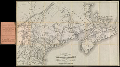
Railroad Map of Northern New England and the Maritime Provinces.
Collection: Osher Collection
Name: Railroad Map of Northern New England and the Maritime Provinces.
Barcode: 1186
Creator: Array
Printmaker: American Photo-Lithographic Company
From Atlas: No
Notes: Notes: "E.G. Foster. Del." and "Am. Photo-Litho. Co. N.Y. (Osbourne's Process)"
Publisher: Loring, Short & Harmon
Date/Date Range Produced: 1882
Date/Date Range Published: 1882
Language: English
Region Depicted: CanadaMaineMaritime ProvincesMassachusettsNew EnglandNew HampshireNova ScotiaVermont
Map Type: Transportation maps
Dimensions: Booklet: H 14.4 x W 9.8 cm
Map: H 41.5 x W 65.4 cm
Material Type: Paper
LC Call Number: G3720 .P3 1882
OCLC: 54831340
Donor: Osher
Subjects: American Photo-Lithographic CompanyLoring, Short & HarmonMaineMaritime ProvincesMassachusettsNew EnglandNew HampshireNova Scotia (Canada)Quebec (Province)RailroadsVermont
Permenant URL: https://oshermaps.org/map/1186.0001