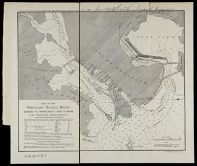
Sketch of Portland Harbor, Maine, showing the improvements made in 1866-86 also projected improvements.
Collection: Osher Collection
Name: Sketch of Portland Harbor, Maine, showing the improvements made in 1866-86 also projected improvements.
Barcode: 1202
Creator: Array
Printmaker: American Graphic Co.
From Atlas: No
Publishing Location: Washington D.C.
Notes: Notes: "To accompany annual report for the fiscal year ending June 30th 1886." and "American Graphic Co., N. Y." "Jared A. Smith Major of Engineers" in manuscript in top margin.
Publisher: United States. Government Printing Office.
Date/Date Range Produced: 1886
Date/Date Range Published: 1886
Language: English
Region Depicted: Cape Elizabeth, MainePortland Harbor, MaineSouth Portland, Maine
Map Type: Nautical charts
Dimensions: H 26 x W 31 cm
Material Type: Paper
LC Call Number:
OCLC: 52890222
Donor: Osher
Subjects: Cape Elizabeth (Me.)Deering (Portland, Me.)Ferry Village (South Portland, Me.)HarborsMaine--MapsNavigation chartsPortland (Me.)Portland Harbor, MaineSouth Portland (Me.)United States. Army. Corps of EngineersUnited States. Government Printing OfficeWharves
Permenant URL: https://oshermaps.org/map/1202.0001