Map of Maine
Collection: Osher Collection
Name: Map of Maine
Barcode: 1263
Creator: Matthews-Northrup Company
From Atlas: No
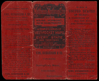
Notes: Inset image: City of Portland and Vicinity.2 maps: left and right halves-left side is Maine and right side is New Hampshire and Vermont; cover of booklet included. Verso of cover: Guide to reading the maps and the regions available in this map series. Verso of map: information regarding Maine and New Hampshire's history, demographics, geography, etc. Note at bottom of map: "Copyright, 1891, by The Matthews-Northrup Co., Complete Engraving & Printing Works, Buffalo and New York" Plate number in lower right corner of map: "1.92".
Publisher: King, Richardson & Co.
Date/Date Range Produced: 1891
Date/Date Range Published: 1891
Language: English
Region Depicted: Maine
Map Type: GeographicalPolitical maps
Dimensions: Cover: 14 x16 cm.; 2 maps: each 34 x 26 cm.
Material Type: Paper
LC Call Number:
OCLC: 856535201
See Also: Map of New Hampshire and Vermont
Donor: Osher
Subjects: CountiesMaine--MapsMatthews-Northrup CompanyMountainsRivers and lakes
Permenant URL: https://oshermaps.org/map/1263.0001; 1263.0002; 1263.0003; 1263.0004; 1263.0005; 1263.0006