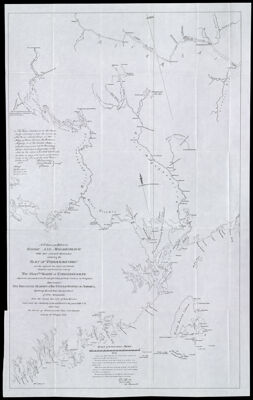
A Plan of the Rivers Scoodic and Magaguadavic with their principal Branches including the Bay of Passamaquoddy and the adjacent Sea-Coast and Islands. Compiled and formed by order of the Honble. Board of Commissioners appointed pursuant to the 5th article of the Treaty of Amity Commerce & Navigation between his Britanic Majesty & the Unites States of America. By George Sproute Esq'r Surveyor Gen'l of New-Brunswick from the actual surveys of those rivers made under the authority of the said board in the years 1796-7-8 and from the survey of Passamaquoddy Bay and Islands made by M. Wright 1772.
Collection: Osher Collection
Name: A Plan of the Rivers Scoodic and Magaguadavic with their principal Branches including the Bay of Passamaquoddy and the adjacent Sea-Coast and Islands. Compiled and formed by order of the Honble. Board of Commissioners appointed pursuant to the 5th article of the Treaty of Amity Commerce & Navigation between his Britanic Majesty & the Unites States of America. By George Sproute Esq'r Surveyor Gen'l of New-Brunswick from the actual surveys of those rivers made under the authority of the said board in the years 1796-7-8 and from the survey of Passamaquoddy Bay and Islands made by M. Wright 1772.
Barcode: 1286
Creator: Sproule, Geo. F. (George F.), 1741-1817
From Atlas: No
Date/Date Range Published: 1895
Language: English
Region Depicted: Passamaquoddy Bay
Map Type: Boundary mapsGeographical
Dimensions: H 84.7 x W 60 cm
Material Type: Paper
LC Call Number:
OCLC:
Donor: Osher
Subjects: BorderlandsBoundariesCoastsIslandsMaine--MapsPassamaquoddy Bay (N.B. and Me.)RiversSaint Croix River (Me. and N.B.)Washington County (Me.)
Permenant URL: https://oshermaps.org/map/1286.0001