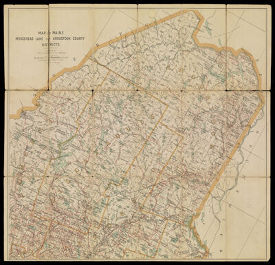
Map of Maine Moosehead Lake and Aroostook County Districts.
Collection: Osher Collection
Name: Map of Maine Moosehead Lake and Aroostook County Districts.
Barcode: 1289
Creator: Anonymous / Unknown Author
From Atlas: No
Publishing Location: Boston (Mass.)
Notes: Below title: "Published by Geo. H. Walker & Co. Boston." The map is segmented and mounted on linen.
Publisher: Geo. H. Walker & Co.
Date/Date Range Produced: 1895
Date/Date Range Published: 1895
Language: English
Region Depicted: Aroostook County, MaineMoosehead Lake, MainePenobscot County, MainePiscataquis County, MaineSomerset County, Maine
Map Type: Boundary mapsGeographical
Dimensions: H 58.5 x W 60.8 cm
Material Type: Paper
LC Call Number: G3734.M59 1895
OCLC: 53285603
Donor: Osher
Subjects: Aroostook County (Me.)LakesMaine--MapsMoosehead Lake (Me.)MountainsPenobscot County (Me.)Piscataquis County (Me.)RiversSomerset County (Me.)Washington County (Me.)Waterways
Permenant URL: https://oshermaps.org/map/1289.0001