Collection: Osher Collection
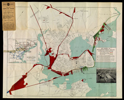
Name: Map Showing the Rail and Water Terminal Facilities of Portland, State of Maine.
Barcode:
Creator:
From Atlas:
Publisher:
Date/Date Range Produced:
Date/Date Range Published:
Language:
Region Depicted:
Map Type:
Dimensions: 68 x 84 cm.
Material Type:
LC Call Number: G3731.P3 J6 1933
OCLC: 76881578
Accession Number: OS-1933-13
Donor:
Subjects:
Permenant URL: