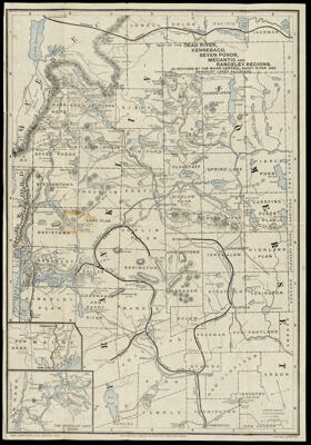
Map of the Dead River, Kennebago, Seven Ponds, Megantic and Rangeley Regions. As reached by the Maine Central, Sandy River and Rangeley Lakes Railroads.
Collection: Osher Collection
Name: Map of the Dead River, Kennebago, Seven Ponds, Megantic and Rangeley Regions. As reached by the Maine Central, Sandy River and Rangeley Lakes Railroads.
Barcode: 1353
Creator: Boothby, Frederic E. (Frederic Eleazer), 1845-1923Coe, Harrie B.
From Atlas: No
Publishing Location: Boston (Mass.)
Notes: Notes: "Copyrighted 1906 by F.E. Boothby, Portland, Maine" and "H.B. Coe, Compiler"
Publisher: Rand Avery Supply Co.
Date/Date Range Produced: 1906
Date/Date Range Published: 1906
Language: English
Region Depicted: Franklin County, MaineSomerset County, Maine
Map Type: GeographicalTransportation maps
Dimensions: H 52.4 x W 36 cm
Material Type: Paper
LC Call Number: G3731.P3 R36 1906
OCLC: 54831770
Donor: Osher
Subjects: Franklin County (Me.)LakesMaine Central Railroad CompanyMaine--MapsRailroadsRand Avery Supply Co.RiversSomerset County (Me.)
Permenant URL: https://oshermaps.org/map/1353.0001