Map of Northern Maine. Specially adapted to the Uses of Lumbermen and Sportsmen Compiled and Published by Lucius L. Hubbard Cambridge, Mass.
Collection: Osher Collection
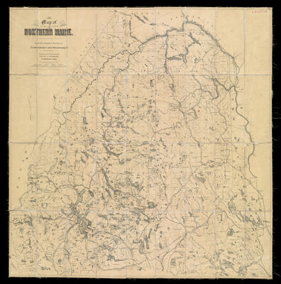
Name: Map of Northern Maine. Specially adapted to the Uses of Lumbermen and Sportsmen Compiled and Published by Lucius L. Hubbard Cambridge, Mass.
Barcode: 1369
Creator: Hubbard, Lucius L. (Lucius Lee), 1849-1933
Printmaker: Meisel, Berthold
From Atlas: No
Publishing Location: Cambridge, MA
Notes: Notes: "Entered according to the act of Congress in the year 1891 by Lucius L. Hubbard in the Office of the Librarian of Congress at Washington D.C." and "For sale by E.F. Dillingham, Bangor, Me." and "B. Meisel, Lith. Boston." Sectioned and linen-backed map. Stamped "L.E. Little" in upper right cornerMap key refers to railroads "to be built in 1909."
Publisher: Hubbard, Lucius L. (Lucius Lee), 1849-1933
Purveyor: Dillingham, E.F.
Date/Date Range Produced: 1899
Date/Date Range Published: 1899
Language: English
Region Depicted: Aroostook County, MainePenobscot County, MainePiscataquis County, MaineSomerset County, Maine
Map Type: Geographical
Dimensions: 83 x 80 cm.
Printing Process: Lithograph
Printing Technique: Planar Surface
Material Type: Paper
LC Call Number:
OCLC: 851193688
Accession Number: OS-1909-24
Donor: Osher
Subjects: Aroostook County (Me.)LakesMaine--MapsMoosehead Lake (Me.)Penobscot County (Me.)Piscataquis County (Me.)RailroadsRiversSomerset County (Me.)Washington County (Me.)Waterways
Permenant URL: https://oshermaps.org/map/1369.0001