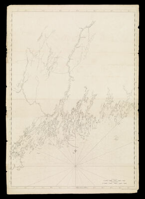
[Coast of Maine from Spurwink River to Moose Point]
Collection: Osher Collection
Name: [Coast of Maine from Spurwink River to Moose Point]
Barcode: 12838
Creator: Des Barres, Joseph F. W. (Joseph Frederick Wallet), 1729-1824
From Atlas: No
Notes: Des Barres chart.Note: "Published according to Act April 24, 1776"
Publisher: Des Barres, Joseph F. W. (Joseph Frederick Wallet), 1729-1824
Date/Date Range Published: Apr 24th, 1776
Language: English
Region Depicted: Gulf of MaineMaine
Map Type: Nautical charts
Dimensions: H 110 x W 77 cm
Printing Process: Engraving
Printing Technique: Copper
Material Type: Paper
LC Call Number:
OCLC:
Donor: Osher
Permenant URL: https://oshermaps.org/map/12838.0001