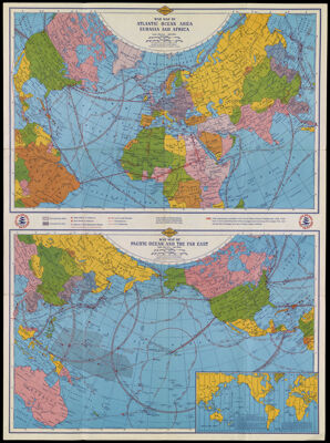
Lowell Thomas' War Map of the World
Collection: Osher Collection
Name: Lowell Thomas' War Map of the World
Barcode: 12975
Creator: Thomas, Lowell, 1892-1981
Publishing Location: Chicago
Notes: Contains 5 maps: 1) Map of the Far East, 2) Map of southern Europe and the Mediterranean Area and the Near East, 3) War Map of Atlantic Ocean Area Eurasia and Africa, 4) War Map of Pacific Ocean and the Far East, 5) World Time ZonesShows Allied, Axis and neutral or non-belligerent bases or stations, areas occupied or controlled by Allies and Axis powers "(Status 5 weeks after U.S. entered the war)."Note: "In the interest of National Defense certain vital military establishments have been omitted from this map."
Publisher: Rand McNally and Company
Date/Date Range Produced: 1942
Date/Date Range Published: 1942
Language: English
Dimensions: 47 x 48 cm or smaller, folded to 23 x 13 cm
LC Call Number: G3201.S7 1942 .R32
OCLC: 707925743
Donor: Osher
Subjects: World War, 1939-1945
Permenant URL: https://oshermaps.org/map/12975.0001; 12975.0002