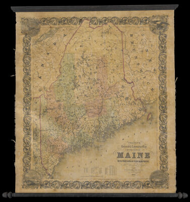
Colton's railroad & township map of the State of Maine, with portions of New Hampshire, New Brunswick & Canada
Collection: Osher Collection
Name: Colton's railroad & township map of the State of Maine, with portions of New Hampshire, New Brunswick & Canada
Barcode: 13262
Creator: Anonymous / Unknown Author
From Atlas: No
Publishing Location: New York
Notes: Includes data from the 1840 and 1850 censuses with information about farming and manufacturing.Illustrations in the corners: A deer; an eagle; Portland.Shows longitude from Washington.
Publisher: J.H. Colton & Co.
Date/Date Range Produced: 1852
Date/Date Range Published: 1852
Language: English
Region Depicted: MaineNew BrunswickNew HampshirePortland, Maine
Map Type: Wall maps
Dimensions: H 105 x W 89 cm
LC Call Number: G3731.P3 1852 .C6
OCLC: 5563818
Donor: Osher
Subjects: CensusCountiesRailroads
Permenant URL: https://oshermaps.org/map/13262.0001