Progress Map of lines and areas of explorations and surveys conducted under the auspices of the war department giving the area of the public domain west of the 100th meridian of longitude with an index illustration of a series of atlas maps prepared under

Collection: Osher Collection

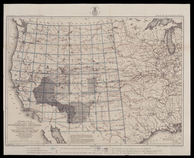
Name: Progress Map of lines and areas of explorations and surveys conducted under the auspices of the war department giving the area of the public domain west of the 100th meridian of longitude with an index illustration of a series of atlas maps prepared under

Barcode: 53352

Notes: Place of publication not identified

Surveyor: Wheeler, George M. (George Montague), 1842-1905

Date/Date Range Produced: 1873

Language: English

Region Depicted: Northwestern United StatesWestern United States

Dimensions:

LC Call Number: G4296.C51 W4 1873

OCLC: 1102681290

Donor: Osher

Permenant URL: https://oshermaps.org/map/53352.0001