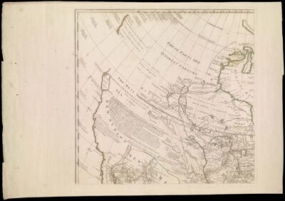
A General Map of North America In which is Express'd the Several New Roads, Forts, Engagements, &c. taken from Actual Surveys and Observations Made in the Army employ'd there, from the Year 1754, to 1761. Drawn by the late John Rocque, Topographer to His Majesty.
Collection: Osher Collection
Name: A General Map of North America In which is Express'd the Several New Roads, Forts, Engagements, &c. taken from Actual Surveys and Observations Made in the Army employ'd there, from the Year 1754, to 1761. Drawn by the late John Rocque, Topographer to His Majesty.
Barcode: 728; 12794; 12795; 12796
Creator: Rocque, John, -1762
Printmaker: Rocque, Mary Ann
From Atlas: No
Notes: Parts 1-4 of 4 part sheet map. Includes historical and exploratory notes.
Publisher: Rocque, John, -1762Rocque, Mary Ann
Date/Date Range Produced: 1761
Date/Date Range Published: 1761
Language: English
Region Depicted: CanadaCentral North AmericaLabrador, CanadaNew EnglandNorth AmericaWestern North America
Map Type: GeographicalHistorical mapsPolitical maps
Dimensions: 87 x 91 cm
Printing Process: Engraving
Printing Technique: Copper
Material Type: Paper
LC Call Number: G3300 1761 .R6
OCLC: 5404725
Donor: Osher
Subjects: CanadaCartouches, Ornamental (Decorative arts)Great Lakes (North America)New EnglandNorth AmericaplantsTrees
Permenant URL: https://oshermaps.org/map/728.0001; 728.0002; 728.0003; 12794.0001; 12795.0001; 12796.0001