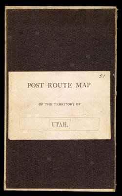
Post route map of the territory of Utah with adjacent states and territories showing showing post offices with the intermediate distances and mail routes in operation on the 1st of December 1884 published by order of Postmaster General Walter Q. Gresham under the direction of W.L. Nicholson, Topographer P.O. Dept.
Collection: Osher Collection
Name: Post route map of the territory of Utah with adjacent states and territories showing showing post offices with the intermediate distances and mail routes in operation on the 1st of December 1884 published by order of Postmaster General Walter Q. Gresham under the direction of W.L. Nicholson, Topographer P.O. Dept.
Barcode: 47041
Creator: Gresham, Walter Quintin, 1832-1895Nicholson, W. L.
Date/Date Range Produced: 1885
Date/Date Range Published: 1885
Language: English
Dimensions: folded to 21 x 13 cm.
Notes: "The service of this diagram brought up to date of Jan. 1st, 1885." Handwritten on cover the number "21".
OCLC: 889351145
Accession Number: OS-1885-55
Donor: Osher
Permenant URL: https://oshermaps.org/map/47041.0001; 47041.0002