A Map of the British and French Settlements in North America.

Collection: Osher Collection

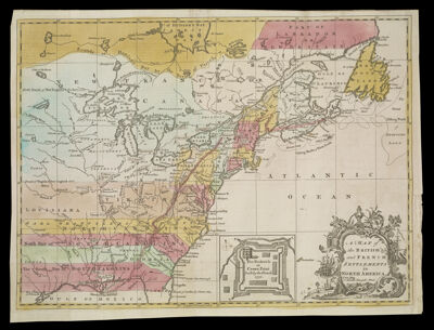
Name: A Map of the British and French Settlements in North America.

Barcode: 47468

Creator: Hinton, John, -1781

From Atlas: No

Date/Date Range Produced: 1755

Date/Date Range Published: 1755

Language: English

Region Depicted: CanadaNew FranceNova Scotia

Map Type: Boundary mapsGeographicalPolitical maps

Dimensions: H 28 x W 38 cm.

Material Type: Paper

LC Call Number: G3300 1755.H5

OCLC: 166634197

Donor: Osher

Subjects: CanadaEast (U.S.)FlowersGreat Lakes (North America)New FranceNova Scotia (Canada)plantsSailing ships

Permenant URL: https://oshermaps.org/map/47468.0001