Collection: Textile Museum Collection
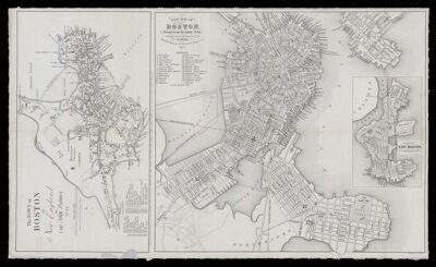
Name: New Map of Boston comprising the whole city with the new boundaries of the wards
Barcode:
Creator:
Publisher:
Publishing Location:
Notes:
Date/Date Range Published: 1853
Language:
Map Type:
Dimensions: 2 maps: 14 x 25 cm and 25 x 28 cm on sheet 43 x 26 cm
LC Call Number: G3764.B6 1853 B6
OCLC: 427008872
Accession Number: ATH-1853-41
Donor:
Permenant URL: