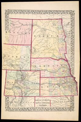
County Map of Dakota, Wyoming, Kansas, Nebraska and Colorado.
Collection: Story Collection
Name: County Map of Dakota, Wyoming, Kansas, Nebraska and Colorado.
Barcode: 2304
Publisher: Mitchell, S. Augustus, Jr. (Samuel Augustus)
Publishing Location: Philadelphia
Notes: Most of map within ornamental border
Sheet numbered "51."
Note below neat line: "Entered according to Act of Congress in the year 1870 by S. Augustus Mitchell, Jr. in the Clerks Office of the District Court for the Eastern District of Pennsylvania"
Date/Date Range Produced: 1870
Language: English
Region Depicted: ColoradoKansasMontanaNebraskaNorth DakotaSouth DakotaWyoming
LC Call Number: G4311.F7 1870 .M58x
OCLC: 1994636
Accession Number: ST-1870-12
Donor: Story
Permenant URL: https://oshermaps.org/map/2304.0001