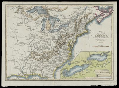
United States of America : Exhibiting the Seat of War on the Canadian Frontier from 1812 to 1815.
Collection: Smith Collection
Name: United States of America : Exhibiting the Seat of War on the Canadian Frontier from 1812 to 1815.
Barcode: 2135
Creator: Cary, John
From Atlas: No
Publishing Location: Leeds, U.K.
Publisher: Baines, Edward
Date/Date Range Produced: 1816
Date/Date Range Published: 1816
Language: English
Region Depicted: Eastern United StatesGulf of MexicoLake ErieLake HuronLake MichiganLake OntarioLake SuperiorNew BrunswickNova Scotia
Map Type: Boundary mapsGeographicalPolitical maps
Dimensions: H 26.8 X W 36.7 cm
Material Type: Paper
LC Call Number: G3700 .C3 1816
OCLC: 8492078
Donor: Smith
Subjects: Baines, Edward, 1774-1848Canada, EasternConnecticutDelawareEast (U.S.)FloridaGeorgiaGreat Lakes (North America)MaineMarylandMassachusettsMiddle Atlantic StatesMiddle WestNative American tribesNew EnglandNew HampshireNew JerseyNew York (State)Newfoundland and LabradorNorth CarolinaNova Scotia (Canada)OntarioPennsylvaniaQuebec (Province)Rhode IslandSouth Atlantic StatesSouth CarolinaUnited States History War of 1812VermontVirginia
Permenant URL: https://oshermaps.org/map/2135.0001