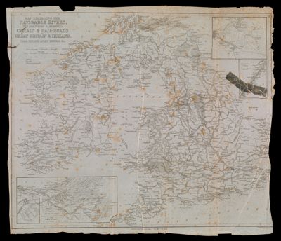
Map Exhibiting The Navigable Rivers, The Completed & Proposed Canals & Rail-Roads of Great Britain & Ireland, With The Coal Fields, Light Houses &c.
Collection: Story Collection
Name: Map Exhibiting The Navigable Rivers, The Completed & Proposed Canals & Rail-Roads of Great Britain & Ireland, With The Coal Fields, Light Houses &c.
Barcode: 4774
Creator: Copley, Charles
Publishing Location: New York
Notes: Note: "Engraved by Charles Copley N. York"Does not include northern and central Scotland.Inset maps: "Dublin Bay" "Caledonian Canal" "Ramsgate Basin Harbour" "River Thames from London to the Goodwin Sands with Part of Kent"
Date/Date Range Produced: 1859
Language: English
Region Depicted: Caledonian Canal, ScotlandDublin Bay, IrelandGreat BritainRiver Thames, England
Dimensions: 52 x 60 cm
LC Call Number: G5740.P53 C6 1859
OCLC: 18264312
Donor: Story
Permenant URL: https://oshermaps.org/map/4774.0001