A Chart of the Sea Coast of New Found Land, New Scotland, New England, New York, New Jersey, with Virignia and Maryland.

Collection: Smith Collection

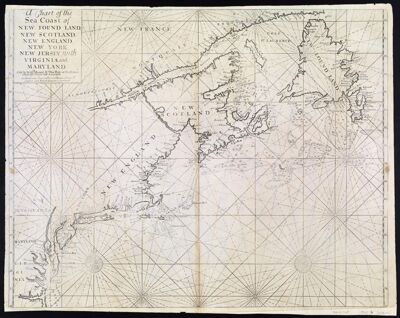
Name: A Chart of the Sea Coast of New Found Land, New Scotland, New England, New York, New Jersey, with Virignia and Maryland.

Barcode: 1863

Creator: Mount, William, -1769

From Atlas: Yes

Notes: From: The English Pilot, 4th book.

Atlas Reference: The English Pilot, 4th book. North Atlantic coast of North America from Virginia to Newfoundland.

Subjects: Array

Publisher: W. & J. Mount & T. Page

Purveyor: W. & J. Mount & T. Page

Date/Date Range Produced: 1737

Date/Date Range Published: 1737

Language: English

Map Type: GeographicalNautical charts

Printing Process: Engraving

Printing Technique: Copper

Material Type: Paper

LC Call Number: G9110 .M6 1737

OCLC: 229892675

Accession Number: SM-1737-2

Donor: Smith

Permenant URL: https://oshermaps.org/map/1863.0001