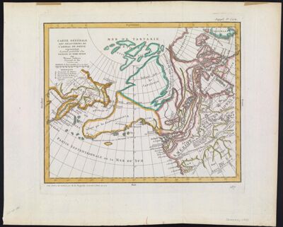
Carte Générale des Découvertes de l'Amiral De Fonte représentant la grande probabilité d'un Passage au Nord Ouest par Thomas Jefferys Géographe du Roi à Londres, 1768.
Collection: Smith Collection
Name: Carte Générale des Découvertes de l'Amiral De Fonte représentant la grande probabilité d'un Passage au Nord Ouest par Thomas Jefferys Géographe du Roi à Londres, 1768.
Barcode: 1981
Creator: Jefferys, Thomas, 1710-1771Robert de Vaugondy, Didier, 1723-1786
From Atlas: No
Publishing Location: Paris
Notes: Note above neat line.: "Suppl. 8e. Carte." Below neat line on right: "167." Below neat line on left: "Cette carte a e?te? traduite par M. de Vaugondy "
Date/Date Range Produced: 1768
Date/Date Range Published: 1772
Language: French
Region Depicted: Arctic OceanNorthwest PassageRussian Far EastSiberia, Russia
Map Type: GeographicalPolitical mapsThematic maps
Dimensions: 29 x 36 cm
Printing Process: Engraving
Printing Technique: Copper
Material Type: Paper
LC Call Number: G3211.S12 1768 .R6
OCLC: 5405011
Accession Number: SM-1772-13
Donor: Smith
Subjects: Arctic OceanCanada, NorthernNorthwest PassageRussian Far East (Russia)Siberia (Russia)
Permenant URL: https://oshermaps.org/map/1981.0001