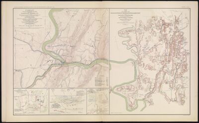
Military map showing the topographical features of the country adjacent to Harper's Ferry, VA. including Maryland, Loudoun and Bolivar Heights, and portions of South and Short Mountains, with the positions of the defensive works, also the junction of the Potomac and Shenandoah Rivers and their passage through the Blue Ridge
Collection: Osher Collection
Name: Military map showing the topographical features of the country adjacent to Harper's Ferry, VA. including Maryland, Loudoun and Bolivar Heights, and portions of South and Short Mountains, with the positions of the defensive works, also the junction of the Potomac and Shenandoah Rivers and their passage through the Blue Ridge
Barcode: 1262
Creator: Davis, George B. (George Breckenridge), 1847-1914Michler, N. (Nathaniel), 1827-1881
Date Created: 1863
Date Published: 1863
Notes: "August 3rd and September 30th"
"October 1st"
"August 9th"
"June 27th"
"June 8th"
1863 - Inscribed on Map; 1862 - Inscribed on Map
Permenant URL: https://oshermaps.org/map/1262.0005