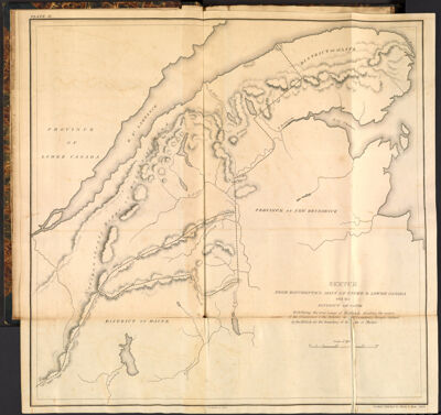
Sketch from Bouchette's maps of upper & lower Canada and the District of Gaspe Exhibiting the true range of Highlands dividing the waters of the St. Lawrence & the Atlantic, a[nd th]e imaginary ranges claimed by the British for the boundary of th[e Sta]te of Maine.
Collection: Osher Collection
Name: Sketch from Bouchette's maps of upper & lower Canada and the District of Gaspe Exhibiting the true range of Highlands dividing the waters of the St. Lawrence & the Atlantic, a[nd th]e imaginary ranges claimed by the British for the boundary of th[e Sta]te of Maine.
Barcode: 3564
Creator: Chapin, William, 1802-1888Greenleaf, Moses, 1777-1834Shirley & Hyde
Date Created: 1829
Date Published: 1829
Printing Technique: Copper
Subjects: Northeast boundary of the United States
Permenant URL: https://oshermaps.org/map/3564.0003