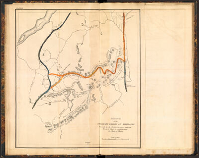
Sketch of the imaginary ranges of highlands Reported by the British surveyors under the Treaty of Ghent, as extending across the state of Maine.
Collection: Osher Collection
Name: Sketch of the imaginary ranges of highlands Reported by the British surveyors under the Treaty of Ghent, as extending across the state of Maine.
Barcode: 3564
Creator: Chapin, William, 1802-1888Greenleaf, Moses, 1777-1834Shirley & Hyde
Date Created: 1829
Date Published: 1829
Printing Technique: Copper
Subjects: Northeast boundary of the United States
Permenant URL: https://oshermaps.org/map/3564.0004