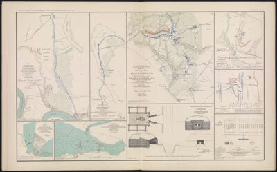
Engineer Office Military Division of the Gulf, Map No. 5. Upper Potomac from McCoy's Ferry to Conrad's Ferry and adjacent portions of Maryland and Virginia, showing the operations of the Army of the Shenandoah, commanded by Maj. Gen. P. H. Sheridan, U. S. A.
Collection: Osher Collection
Name: Engineer Office Military Division of the Gulf, Map No. 5. Upper Potomac from McCoy's Ferry to Conrad's Ferry and adjacent portions of Maryland and Virginia, showing the operations of the Army of the Shenandoah, commanded by Maj. Gen. P. H. Sheridan, U. S. A.
Barcode: 3779
Creator: Davis, George B. (George Breckenridge), 1847-1914Gillespie, George L.Helmle, L.Reese, C. B. (Chauncey B.), 1837-1870
Date Created: 1866
Date Published: 1866
Notes: Maps made by compiling other maps and sources, these authorities are listed on the maps.
"October, 1865."
"October 19, 1864."
"October 9, 1864."
"December, 1864."
"February 3, 1866."
"December 10, 1864."
"December 11, 1864."
"December 12, 1864."
"December 9, 1864." 1865 - Inscribed on Map; 1864 - Inscribed on Map; 1866 - Inscribed on Map
Permenant URL: https://oshermaps.org/map/3779.0009