Collection: Osher Collection
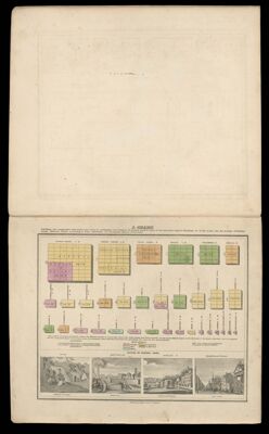
Name: A chart exhibiting the comparative size population form of government and number of square miles in each of the principal Empires, Kingdoms &c of the globe: Also the manner of building among different nations according to the civilization, to accompany Olney's Geography
Barcode:
Date Published: 1837
Publisher:
Permenant URL: