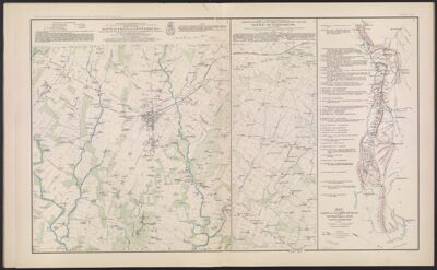
Map of the Battle-Field of Gettysburg.
Collection: Osher Collection
Name: Map of the Battle-Field of Gettysburg.
Barcode: 3784
Creator: Chase, Edwin A.Chase, W. H.Dager, John H.Davis, C. E.Davis, George B. (George Breckenridge), 1847-1914Frink, Harry ArthurHill, W. F.Hinman, F. A.Maxson, Frank O.Trill, C. F.Turtle, ThomasWansleben, W. A.
Date Created: 1868 - 1869
Date Published: 1868 - 1869
Notes: H. A. Frink listed on the map. This is most likely Harry Arthur Frink, however, it is possible that this is not the case. Further research into this may be warranted.
John B. Bachelder is also likely John Badger Bachelder. This also may warrant further inquiry.
"Between October 21, 1868 and October 23, 1869."
"July 3, 1863."
"June 9, 1880." 1868 - Inscribed on Map; 1869 - Inscribed on Map; Between 1868 and 1869; 1863 - Inscribed on Map; 1880 - Inscribed on Map
Permenant URL: https://oshermaps.org/map/3784.0011