Collection: Osher Collection
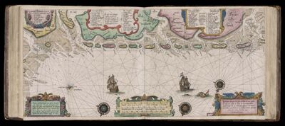
Name: Caarte No. 20 || Chart number 20: description of all the isles and seaports along the coasts of Friesland, Groningen, Emden, etc., from the Vlieland up to the the River Elbe.
Barcode:
Creator:
Date Created:
Date Published:
Language:
Region Depicted:
Subjects:
Permenant URL: