Collection: Osher Collection
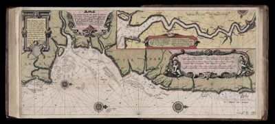
Name: Caarte No. 41 || Chart number 41: True description of the sea coasts of England between Dover and Yarmouth, and also showing the location of the mouth of the Thames.
Barcode:
Creator:
Date Created:
Date Published:
Language:
Region Depicted:
Subjects:
Permenant URL: