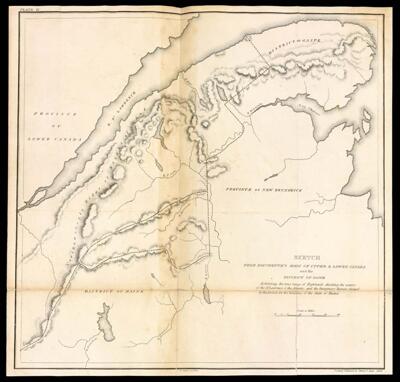
Sketch from Bouchette's maps of upper & lower Canada and the district of Gaspe Exhibiting the true range of highlands dividing the waters of the St. Lawrence & the Atlantic, and the imaginary ranges claimed by the British for the boundary of the State of Maine.
Collection: Osher Map Library Collection
Name: Sketch from Bouchette's maps of upper & lower Canada and the district of Gaspe Exhibiting the true range of highlands dividing the waters of the St. Lawrence & the Atlantic, and the imaginary ranges claimed by the British for the boundary of the State of Maine.
Barcode: 45936
Creator: Chapin, William, 1802-1888Greenleaf, Moses, 1777-1834
Date Created: 1829
Date Published: 1829
Notes: 1829 - Copyright
Permenant URL: https://oshermaps.org/map/45936.0020c