Collection: Smith Collection
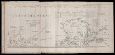
Name: A Chart of North and South America, including the Atlantic and Pacific Oceans, with the nearest Coasts of Europe, Africa, and Asia.
Barcode:
Creator:
Date Published: Jun 10th, 1775
Content:
Subjects:
Publisher:
Language:
Region Depicted:
Dimensions: Map: H 45.5 x W 111cm on sheet: H 54.5 x W 116 cm
Printing Process:
Printing Technique:
Permenant URL: