Collection: Smith Collection
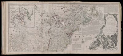
Name: An Accurate Map of North America. Describing and distinguishing the British and Spanish Dominions on this great Continent; According to the Definitive Treaty Concluded at Paris 10th Feb. Y 1763
Barcode:
Creator:
Printmaker:
Date Published: 1775
Content:
Subjects:
Surveyor:
Publisher:
Language:
Region Depicted:
Dimensions: Map: H 50.5 x W 116 cm on sheet: H 54.5 x W 121 cm
Printing Process:
Printing Technique:
Permenant URL: